
Parks Canada Tourism Map
Employer
Parks Canada
Year
2023 - 2024
The goal of this project was to update the old tourism map for The Forks National Historic Site and highlight the bank of the Red River that Parks Canada administers. The map would go on to be used in the Parks Canada Manitoba “Discovery Guide.” A promotional booklet that highlights all Parks Canada historic sites in Manitoba.

Final Piece
Process
Roughs
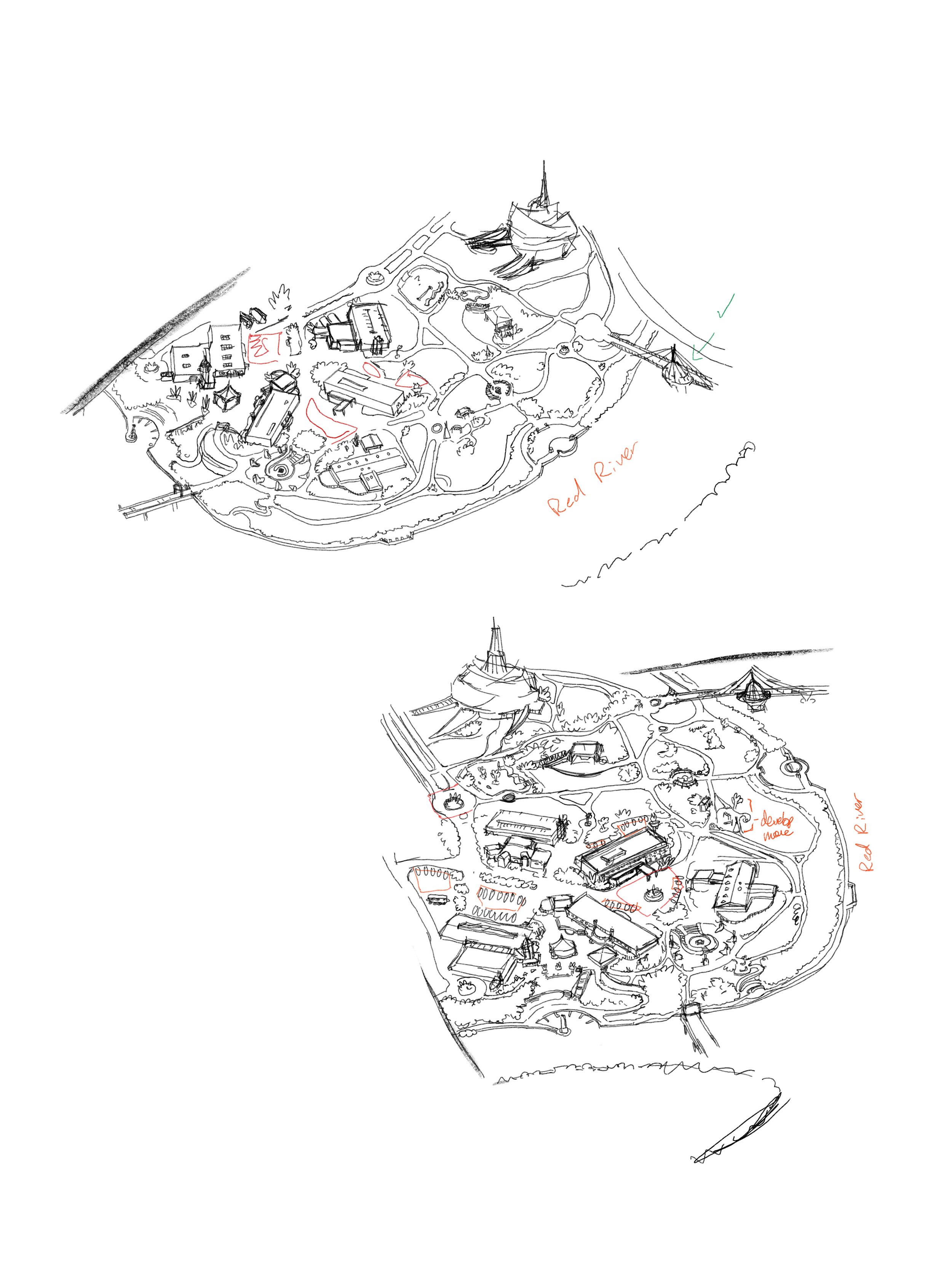
The first large decision was which angle to approach the map from. The goal was to highlight the Parks Canada side of the Forks. By workshopping angles I came away with two main versions of the map which were brought to my supervisor for approval.
Tonal Map
I created a tonal map next to ensure my values would be correct when moving into the final coloured version. This also allowed for easier tweaking from other designers when the map was moved into print.

Full Colour
Choosing the colours was one of the more difficult parts of this project. I didn’t want to pull away from the greens and struggled to keep the greys from overpowering the rest of the piece.
After looking at other maps online and gaining more inspiration from those pallets, I was able to create this final version that I am super happy with!
You can see this map in discovery guides across Manitoba at any Parks Canada historic site.